Planning a custom home in Park City or Hideout and trying to figure out where, exactly, you can build? On a mountain or lake-view lot, small placement choices have big effects on views, costs, and approvals. In this guide, you’ll learn what a building envelope is, how setbacks, height, slopes, and view corridors shape it here, and how to protect your sightlines while streamlining design. Let’s dive in.
Building envelope, plain-English definition
A building envelope is the three-dimensional area on your lot where construction is allowed without extra variances. It is often shown on the recorded plat or site plan as a polygon with dimensions. It wraps in horizontal setbacks, vertical height limits, slope restrictions, easements, and other site constraints. Think of it as the legal and design “box” for your home and major site work.
Why it matters on mountain and reservoir lots
In the Park City and Jordanelle area, envelopes help protect steep slopes, ridgelines, sensitive vegetation, and water quality. They also help preserve neighbors’ views and the scenic character that attract buyers to second-home communities. Your envelope guides where the house, driveway, utilities, and many retaining walls can go. Moving or expanding it later often requires approvals that add cost and may be denied.
What shapes an envelope in Park City and Hideout
Rules vary by location. Parcels around Jordanelle can fall under Park City, Summit County, the Town of Hideout in Wasatch County, or unincorporated areas. Always confirm the jurisdiction and zoning before you assume standards.
Setbacks and zoning
Setbacks are minimum distances from lot lines, roads, water features, and other elements. They often form the outer boundary of your envelope. Subdivision plats, PUD approvals, and CC&Rs can impose stricter setbacks than base zoning. Read recorded plat notes carefully, since they control the buildable area.
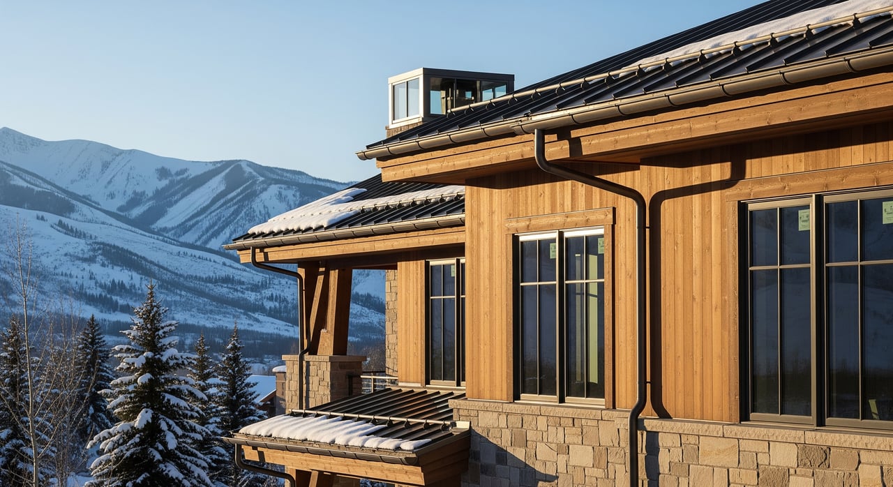
Height limits and ridgeline controls
Height limits cap the vertical size of your home to reduce visual bulk from public view points and ridgelines. Codes differ on how height is measured, which can affect roof design and where the highest portions of the home should sit. Lot orientation and topography often dictate massing so you stay within height and protect downstream views.
Slopes, grading, and geotechnical
Steep slopes can trigger special engineering, tighter setbacks, or “no-build” areas to prevent erosion and drainage problems. Many steep lots need retaining walls or specialty foundations, which themselves may face height or footprint limits. A topographic survey and geotechnical report early in the process help define a realistic envelope and budget.
View corridors and scenic resources
Some communities or jurisdictions protect specific sightlines to the lake, valleys, or peaks through view corridor policies or easements. Even if a plan fits within setbacks and height, design review can request adjustments to minimize blocked views. Mass and rooflines often shift to honor view corridors without losing livability.
Easements and environmental protections
Utility and drainage easements, rights-of-way, and conservation or open-space areas reduce the usable footprint. Near Jordanelle, water-quality protections and buffers can further limit disturbance. Recorded easements override other allowances, so verify them before you finalize your design.
Neighborhood governance
Many Park City and Jordanelle-area neighborhoods have HOAs, CC&Rs, and design review boards. These can set envelopes, design materials, colors, and view-preservation rules that are stricter than municipal codes. Expect separate HOA design approvals in addition to municipal permits.
Access, fire, and utilities
Fire access, turnarounds, road width, and defensible space standards can shape driveway location and orientation. Utility plans for sewer or septic, water, and power also affect grading and siting. On more remote lots, septic placement may be restricted by slopes and setbacks, which ties directly into your envelope.
Protect your views and approvals
Smart planning starts with mapping constraints on one site plan. Plot setbacks, easements, critical slopes, ridgelines, and any view corridors. Then run simple 3-D massing or shaded profiles from key vantage points to check potential view impacts. Early visuals save time and can prevent costly redesigns.
A practical early-steps checklist
- Confirm jurisdiction and zoning for your parcel (Park City, Summit County, or Town of Hideout/Wasatch County).
- Gather recorded documents: plat with any building envelope or plat notes, CC&Rs, and HOA design guidelines.
- Order a title report to identify easements and restrictions.
- Hire a licensed surveyor for a boundary and topographic survey.
- Engage a civil and geotechnical engineer for slope and soil stability and utilities feasibility.
- Consult an architect experienced in Park City-area codes for early massing studies.
- Request a pre-application meeting with the local planning department.
- If in an HOA, seek preliminary design review feedback early.
- Map all constraints on one site plan to define the practical envelope before detailed design.
- Anticipate erosion and sediment control requirements during construction, especially near reservoirs and watersheds.
Can you move or enlarge the envelope?
Sometimes. Changes often require an administrative adjustment, a variance, or a plat amendment with public review. Approval depends on impacts to protected resources, viewsheds, and neighbors. Expect added time and cost, and weigh those against the benefits before you proceed.
How Golden Eagle helps you build with confidence
If you value estate-sized lots and panoramic vistas, the Golden Eagle community on the Jordanelle’s eastern shore pairs half-acre-plus homesites with a curated custom-build path. You can tour view-oriented sites, explore siting options that honor setbacks and height, and meet preferred builders who understand mountain massing and slope work. The experience is concierge-level, designed to reduce friction for owner-builders and second-home buyers while protecting the scenic character that makes this location special.
Final thoughts
A building envelope is not just a line on a map. It is the framework that protects views, manages slopes and water quality, and sets you up for a smoother approval process. Understand it early, design with it in mind, and you will save time, protect your investment, and enjoy the views you came for.
Ready to walk a view lot and talk through the envelope on your shortlist? Schedule a personal tour with Carlos Bocanegra for on-site insight and preferred builder introductions.
FAQs
What is a building envelope in Park City?
- It is the three-dimensional area on your lot where you can build without extra variances, shaped by setbacks, height limits, slopes, easements, and design rules.
How do setbacks affect where I can build?
- Setbacks create the horizontal boundary of the buildable area, often forming the outer edge of the envelope on the recorded plat.
Do steep slopes reduce buildable area?
- Not automatically, but steep-slope rules and geotechnical limits often shrink the practical footprint and increase engineering and construction costs.
Who approves changes to a building envelope?
- Municipal or county planners enforce codes, HOAs enforce CC&Rs and design rules, and recorded plat notes control legally; changes may require formal public review.
How long do approvals take in Park City or Hideout?
- Timelines vary; early pre-application meetings and preliminary HOA reviews can shorten the process, while variances or amendments add weeks to months.
What changes if my lot is near Jordanelle Reservoir?
- Expect stricter water-quality and erosion controls and careful review of disturbance limits and visual impacts from public recreation areas.